Mapping Forage Fish Spawning Sites
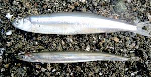 On June 22 and 23, volunteers assembled on a beach in San Pariel to learn how to identify and map forage fish spawning sites under the instruction of Ramona de Graaf, Independent Researcher and Co-ordinator of the Shore Spawner's Alliance. The BC Shore Spawners Alliance is an alliance of community groups working to document and protect the intertidal spawning habitat of forage fish, specifically surf smelt (top in picture) and Pacific sand lance (bottom in picture). So what are forage fish and why are they so important?
The following is from the Islands Trust Fund website.
"Forage fish are small fish that travel in large schools and are a food source or 'forage' for larger fish and marine mammals. Forage fish, including Pacific herring, Pacific sand lance and surf smelt form the cornerstone of marine food webs. They, and other forage fish species play an important role in the diets of Humpback Whales, Porpoise, Sea Lions, Seals, Salmon and marine birds.
From sand grains to whales, it's all connected. Surf smelt and Pacific sand lance lay tiny eggs (1mm) on pebble and sand beaches just below the high-tide line - an area called the intertidal zone. The number and health of these beaches play an important role in the lives of the salmon, whales and marine birds that rely on each generation of forage fish for food."
Our actions on and around these beaches, like shoreline development, can impact forage fish habitat, so it is important to identify and map these areas.
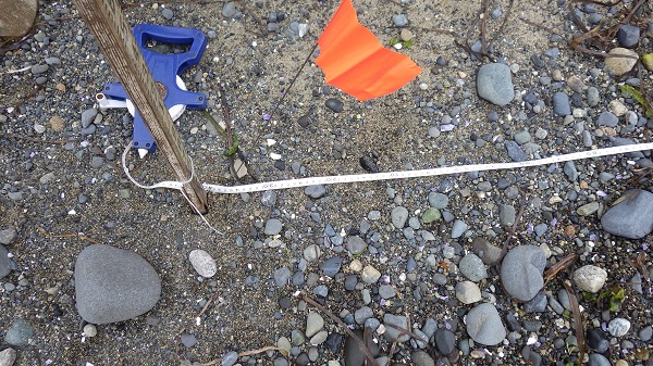
We first selected three 30 m stretches of fine sand and pebbles, and scooped up the top layer along each 30 m line to make a sample. The co-ordinates for the start and finish of each stretch were taken with a GPS so that they can be placed on a map.
Then we seived and "winnowed" the sand samples to bring any eggs and embryos to the surface. This is a technique similar to panning for gold except no one has been able to retire on it. The top layer of sand, where we hoped the eggs and embryos surfaced, was collected from each pan and put in a jar.
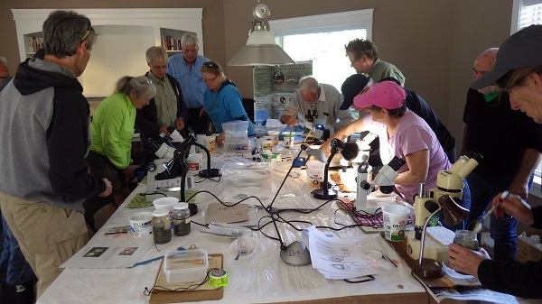
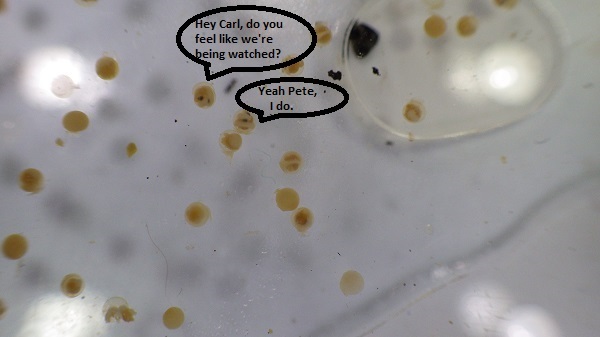
The samples were taken back to our makeshift mad-scientist laboratory where we got to play CSI. No, not really. We placed small portions of the sand samples under microscopes to search for eggs and embryos. The photo below shows what the eggs and embryos look like under the microscope.
We hope to sample and map the stretch of coast line from Parksville to Qualicum Beach. Should be loads of fun and who knows, we may just find gold.