Wetland Survey in the C.W. Young Side Channel
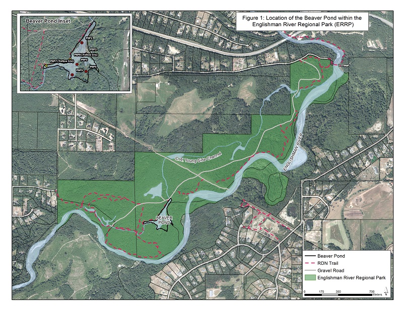
The C.W. Young Side Channel is a channel constructed off the Englishman River within the Englishman River Regional Park (ERRP). The side channel is a Fisheries and Oceans Canada (DFO) salmon enhancement operation, intended to provide over-wintering habitat for Coho Salmon fry reared in the Englishman River. Beaver dams within the channel have created the 2.8 ha marsh wetland called the Beaver Pond. A map showing an overview of the Beaver Pond in the ERRP is below.
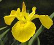 In 2018, two small colonies of yellow iris (shown in the photo to the left), an invasive species that fills in wetlands and displaces aquatic habitats, were discovered in the Beaver Pond. This was a real concern for us, as well as for the Regional District of Nanaimo Parks Department (RDN), because Coho fry inhabit the Beaver Pond. Their habitat was at risk of filling in with yellow iris, leaving no open water for the fish. Plus, the yellow iris would probably spread into other areas of the side channel where Coho fry inhabit.
The RDN contracted the Coastal Invasive Species Committee to remove the yellow iris in summer of 2019 with financial assistance from DFO. MVIHES was asked to monitor the Beaver Pond for five years, starting in 2019, to document the success of the eradication of the yellow iris and identify other infestations of invasive species.
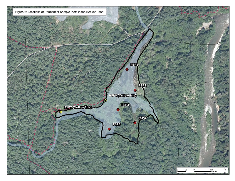
For those of you who have taken the Wetlandkeepers course, you know that the typical method for assessing wetlands is to establish a number of transects that cross the wetland in several locations and collect information on vegetation while walking along the transects. Since we would be monitoring the wetland every year for five years, we chose a method that was first developed by the forest industry: Permanent Sample Plots, or PSP's. A PSP allows you to go to the same location year after year and monitor for changes without having to assess the entire area which would be very labour intensive. The information collected was based on the guidelines in the Wetlandkeepers Handbook. MVIHES selected seven locations for PSPs, two which included the yellow iris infestations. A map showing their locations is below.
So what did we find? Well, we didn't find any yellow iris because the Coastal Invasive Species Committee had done an awesome job of removing it a few weeks before we surveyed those plots. Unfortunately, we found that six of the seven plots contained another invasive species: reed canary grass. And reed canary grass was the dominant species in five of those six plots! You can read the technical report for last year's monitoring here.
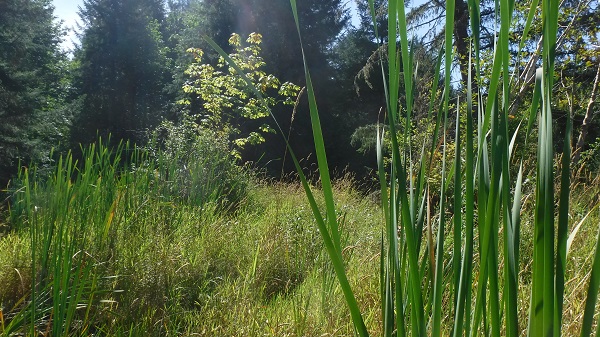
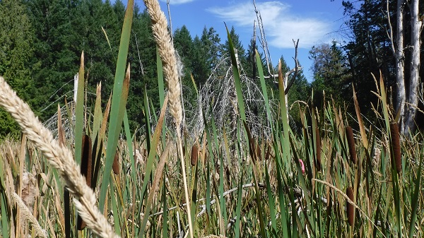 Reed canary grass is a perennial sod-forming grass species that prefers wetlands. Sod-forming means it creates it's own soil and changes a marsh into a dry meadow. You can see tall stalks of the grass growing amongst cattails in the photo on the left. Although reed canary grass is native in North America, varieties of this grass have been introduced from Europe and Asia. These varieties are aggressive in the central and western regions of North America, invading and filling in wetlands. The most probable source of the aggressive variety in the wetland are seeds from pasture grasses and hay bales for cattle and horses on local farms. Seeds may have been carried into the wetland by wind or birds, or arrived in the hair of horses and dogs on the park trails.
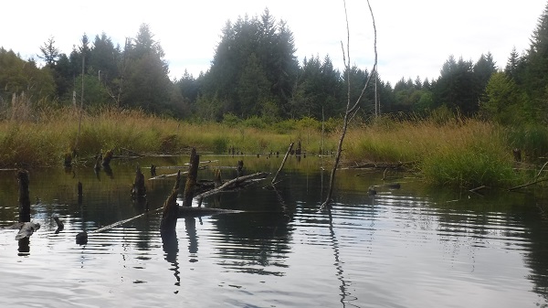 The only plot that did not contain reed canary grass is shown on the right. Many Coho fry were observed in this plot which was all open water, meaning there was no vegetation growing out of the water like cattails or grass. Reed canary grass can be seen in the background. This plot was the deepest with a 1.2 m water depth which is probably too deep for the grass to establish. All other plots had depths between 0.0 m and 0.5 m.
Open water occupied 10 percent to 40 percent of the area in other plots, but the only one where coho fry were observed is shown in the photo on the left. The rest of the areas within the plots contained mostly reed canary grass with some cattails, rushes, sedges, and shrubs like salmonberry, elderberry, hard hack, willows, black twinberry and Pacific nine-bark.
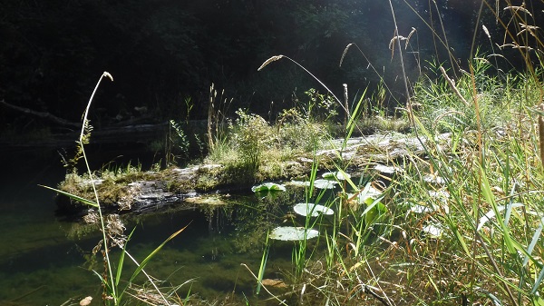
The reed canary grass is an even bigger threat to fish habitat in the wetland than the yellow iris because of the extent to which it has invaded. There is no easy way to remove or control it. The photo to the right shows how the grass has filled in the open water that existed between cattails in most of the plots. When the grass has filled in the spaces, shrubs and trees are able to encroach, turning the marsh into a wet meadow and eventually a woodland.
We are in communication with the RDN to find an approach for managing the reed canary grass. In the meantime, we have almost completed this year's survey of the PSP's and will be interpreting the results in a report.