2025 AGM Announcement
"Committed to the restoration of wild Pacific salmon in mid Vancouver
Island watersheds through habitat restoration and community engagement"
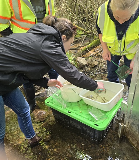
Three employees from the City of Parksville Engineering Department joined us yesterday at our salmon smolt trap on Shelly Creek.
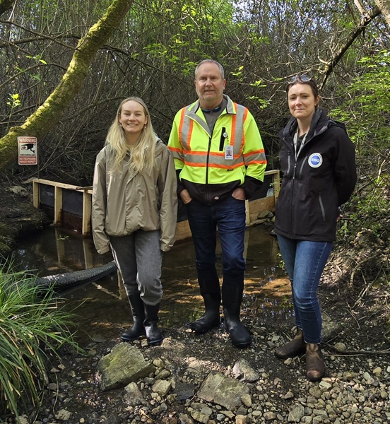
From left to right are Marie Whibley (GIS Mapper), Shawn Boven (Director of Engineering and Technology Systems), and Kate Pocock (Emergency Program Coordinator). They helped count and measure the Coho Salmon smolts captured in our trap during their migration out of Shelly Creek to the Englishman River on their way to the ocean.
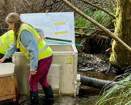 The trap includes a fence and pipe (seen in the above photo) and a metal box (left-hand photo). The fence directs the fish swimming down the creek through a pipe into the smolt box.
Before we installed the smolt trap on March 28, MVIHES Board Member Terry Baum made a lot of much-needed repairs and improvements to the smolt fence with funding from a grant from the Pacific Salmon Foundation. Thank you, Terry!
Thomas Negrin and Ally Badger of the BC Conservation Foundation (BCCF) worked alongside our volunteers to install the trap which we much appreciate.
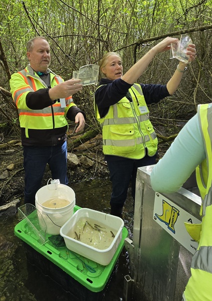
Each morning at 9 am, volunteers open the smolt box to identify and count the fish. We measure the length of 10 out of every hundred salmon smolts. The photo to the right shows MVIHES Vice President Maggie Estok and Shawn measuring the length of smolts using little water troughs with built in rulers. Once counted and measured, the fish are placed in a pail with an aerator. Rainbow and Cutthroat Trout are also captured and measured, some exceeding 30 cm in length! This important data is entered into a spreadsheet and sent to Department of Fisheries and Oceans AND the BC Ministry of Water, Land, and Resource Stewardship by our awesome Team Leader, Shelley Goertzen.
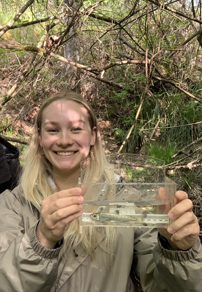
In the above photos Kate scoops out some fish with a small net and counts them as she places them into a pail, and Marie shows off one of the fish she measured. The smolts and trout in the pail are then placed into a “holding box” for Ally at BCCF to PIT Tag before she releases them into the creek. You can read all about the fascinating PIT Tagging program here.
Yesterday we counted 110 smolts and today we counted 275 plus 2 Rainbow Trout. That makes 2969 Coho Salmon, 75 Rainbow Trout, and 9 Cutthroat Trout counted since March 28 and there are still a few weeks to go before the migration ends. It's not too late to participate in this year's smolt count. You can sign up here.
Learn more about Shelly Creek and its importance to salmon and trout at this link. Shelly Creek - MVIHES (Mid-Vancouver Island Habitat Enhancement Society)
Many thanks to Shawn, Kate and Marie from the City for their participation, and to our volunteers: Shelley Goertzen, Terry Baum, Denis Cote, Dick Dobler, Maggie Estok, Gene Gapsis, Jeff Allen, Carmel Lowe, Bob Williams, Pete Law, Craig Wightman, Tyler Dobler, and Jessica Stockholder.
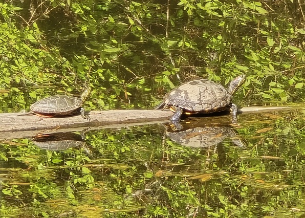
Look who showed up on Martindale Pond (part of Shelly Creek) across the road from our trap. It's Martin the turtle (on the right) and friend. Would his friend's name happen to be Dale, you know, Martindale? They're basking on the log installed by BCCF for just that purpose following our restoration of the pond. You can read about that here. Restoring Martindale Pond Fish Habitat - MVIHES (Mid-Vancouver Island Habitat Enhancement Society)
Our forage fish volunteers recently added 2 more sites to their list of 11 sites for monitoring Forage Fish Spawning Habitat. Our monitoring sites include beaches from Craig Bay to Yambury Rd in French Creek. The 2 new sites are on the restored beach of the Nature Trust property on Mariner Way in the Kw’a’luxw (Englishman River) Estuary. Exciting, eh?
The forage fish program is run by the great folks at Mount Arrowsmith Biosphere Region Research Institute (MABRRI) who provide us with training, equipment, and sampling results.
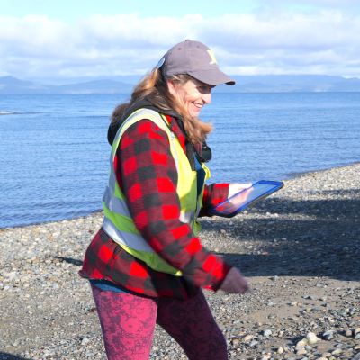
MVIHES Volunteer and Project Leader, Shelley Goertzen, is seen in the photo to the left.
Forage fish are small fish that travel in large schools and are a food source, or ‘forage', for larger fish and marine mammals. Forage fish, including Pacific herring, Pacific sand lance and surf smelt form the cornerstone of marine food webs. They play an important role in the diets of salmon, humpback whales, porpoises, sea lions, seals, and marine birds.
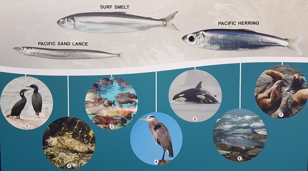
While herring lay eggs 1 to 1.4 mm in size on kelp and eel grass, surf smelt and Pacific sand lance lay tiny eggs (1mm) on pebble and sand beaches just below the high-tide line - an area called the intertidal zone. It’s the surf smelt and sand lance spawning habitat we are monitoring, although we’ve only ever found sand lance eggs. Surf smelt are found further south.
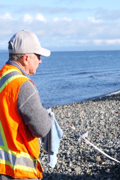
Every month since 2018, MVIHES volunteers haven been visiting beaches at low tide to map spawning sites and collect habitat data along with sand samples to see if they contain eggs. Samples are collected from plots set up in the intertidal zone of established monitoring sites. The photos below show volunteers in action.
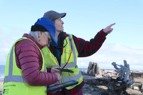
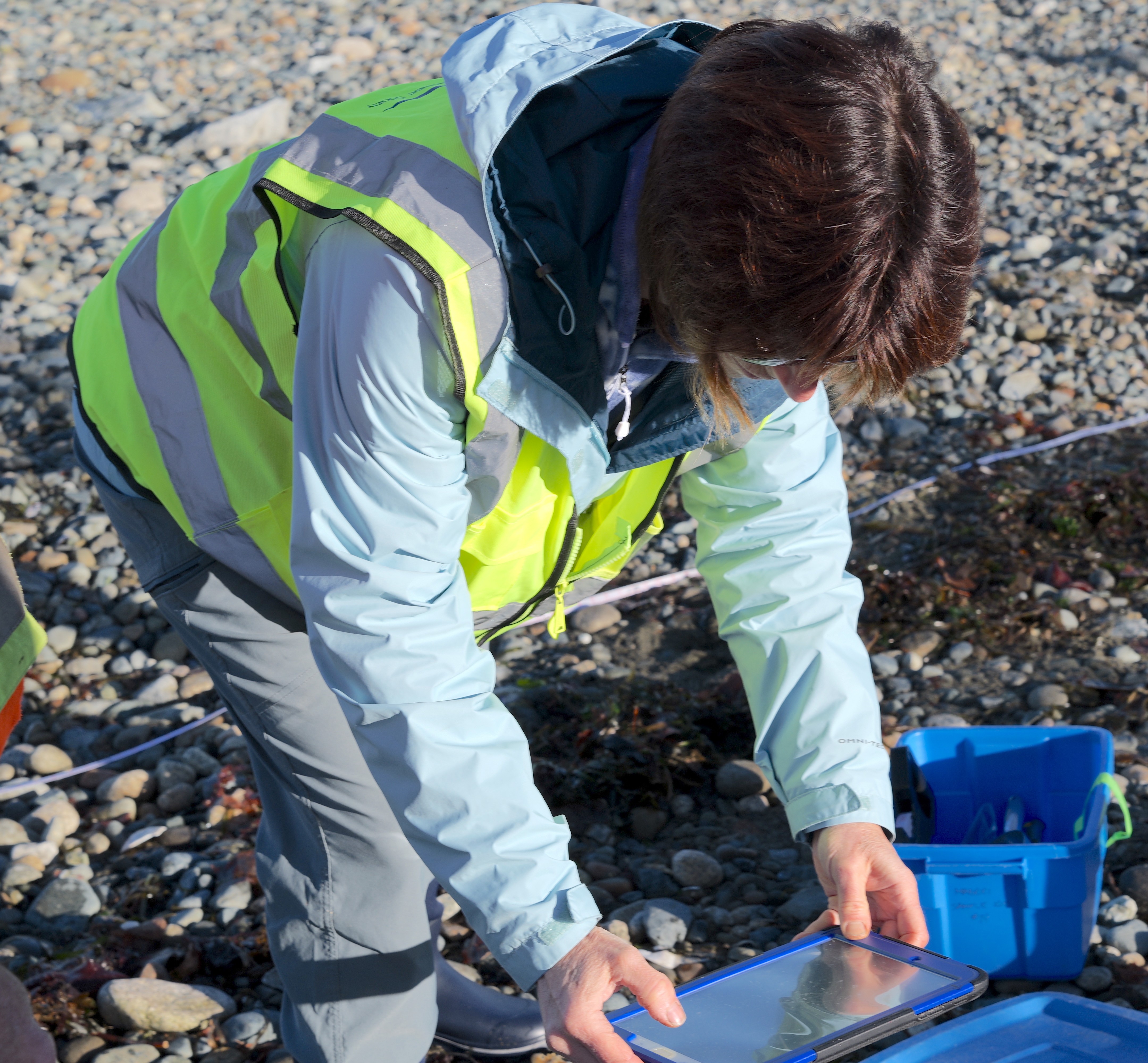
Mark Hogg lays out a sample plot with a measuring tape Mary Campbell enters habitat data digitally into a pad (what a tech savvy group!)
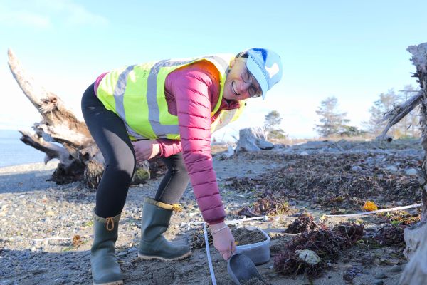
Nanzy Pezel collects more habitat data Mary Campbell collects a sand sample
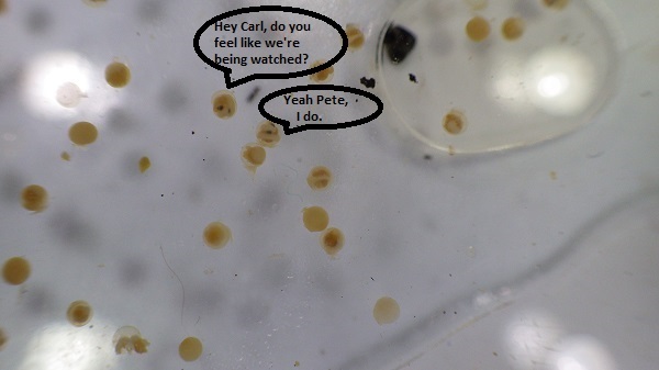
Samples are sieved and "vortexed" to sort out the right sized sand grains on which forage fish eggs are attached. The sorted sand from each site is checked under a microscope by MABRRI for the presence of eggs and embryos. Once eggs have been identified by MABRRI, they are sent to experts in Washington State for confirmation.
So, why are we monitoring and mapping forage fish spawning habitat? One of MABRRI's project objectives is to submit data into the Pacific Salmon Foundation Marine Data Centre, allowing data availability to inform policy change. For example, the Department of Fisheries and Oceans has "timing windows" which are periods when it is safe to conduct work on shorelines without damaging fish and fish habitat. The winter timing window for fish is December 1 to February 15. Our data shows that the sand lance spawning season extends into December and January when it is assumed safe for shoreline disturbance.
Last month, MABRRI reported the following sites contained suspected sand lance eggs:
Parksville Community Park Site 2
San Pareil Site 2
San Pareil Site 3
San Pareil Site 4
French Creek Marina
No, these do not include the 2 new sites but don't be disheartened. We're sure sand lance eggs will eventually show up in our samples from the newly restored beach habitat. Below is a photo of a view of eggsthrough a microscope
Many thanks to our partners at MABRRI and our Forage Fish volunteers: Brenda Riley, Catherine Watson, Gene Gapsis, Majory McFadyen, Mark Hogg, Mary Campbell, Nancy Pezel, Pat Ashton, Shelley Goertzen and Sue Wilson.