One gorgeous weekend in June, seventeen volunteers gathered at French Creek to learn how to assess fish habitat and stream health through a Streamkeeper Course. The course is available from the Pacific Streamkeepers Federation who provide support and education to groups like MVIHES.
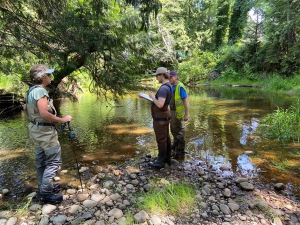
Led by our awesome instructor Michele Jones of Mimulus Biological Consultants, we spent a few hours each day in a classroom at the Parksville Community Centre on Mills St. Then we put what we learned into practice in French Creek.
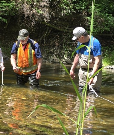
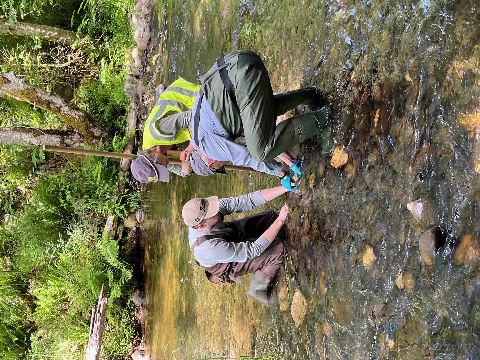
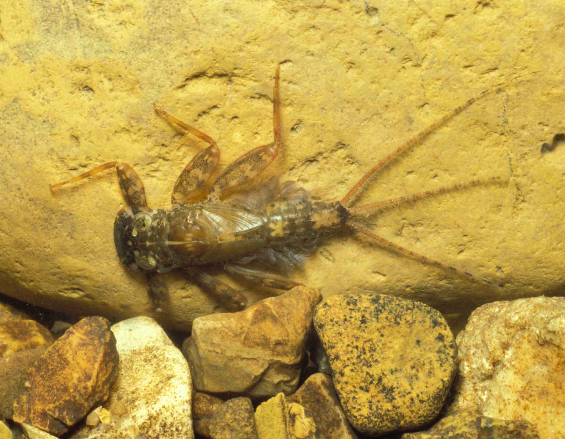
This included taking measurements of water depths, creek widths, oxygen levels, numbers and lengths of pools and riffles. We even measured the amount of gravel and rocks on the creek bottom (left-hand photo below). We collected insects from the creek bottom using a net (right-hand photo below) and took them back to the classroom to identify.
Did you know you can assess the health of a stream by the species of insects living on the bottom? We did this in 2019 on the Englishman River and its tributaries. You can read about it here.
It seems we arrived at French Creek just in time for a hatch of May Flies. Scores of teeny tiny newborn May Fly nymphs (left-hand photo magnified a billion times) were in our samples among other critters like Stone Fly and Caddis Fly nymphs, water mites, and midge and Water Snipe larvae. Some of us older visually challenged folks relied on the experienced eyes of Michele Jones to identify those annoying tiny May Fly nymphs (they did that on purpose!).
Other important features of a creek are the amount of vegetation on the creek banks for stabilizing the banks and the amount of shade provided by trees. Tree roots and logs that hang over or into the water are important for providing cover for young fish from predators as well as shade. We recorded creek measurements and information on field data sheets.
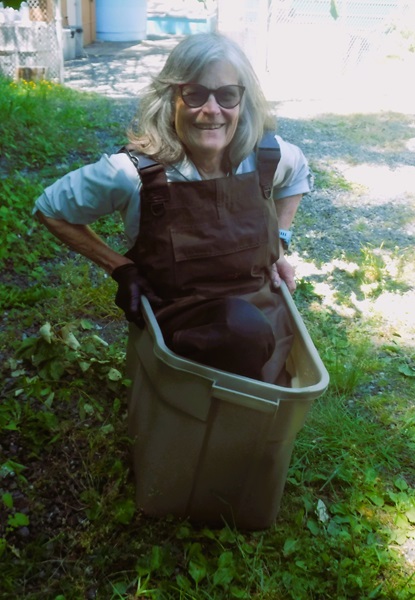
Before we returned to the classroom on the final day we made sure to rinse off our boots/chestwaders and equipment in a 10 percent bleach solution. This is important for preventing the spread of diseases like didymo, commonly known as rock snot, and whirling disease. Volunteer Gene Gapsis (right-hand photo) took this task most seriously.
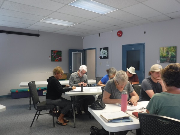
We brought our field data sheets back to the classroom and copied the information onto assessment sheets that give a score for the various creek features Overall, the small section of French Creek we assessed has Acceptable fish habitat.
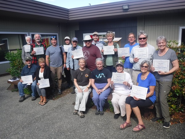
And then we graduated from Streamkeeper School. Starting at the back, from to left to right, are Glen Stedham, Bob Williams, Chris Alexander, Matthew Stoltz, Ed Wasiak, Paul Sim, Logan Pike, Liz Campbell, Chris Smith, Craig McFadyen, Kathy Miller. In the front from left to right are Mark Hogg, Darlene Norring, Michele Jones, Kelly, Barb Riordan, Gene Gapsis. Missing in action: David Belitsky
You may have already read the news about a toxin found in tires that killed salmon in Brothers Creek in West Vancouver and in Piercy Creek in the Comox Valley. 6PPD is a tire preservative which becomes 6PPD-quinone when it reacts with ozone in the air. This chemical collects in rainwater and is lethal to Coho Salmon at a concentration of 0.8 parts per billion.
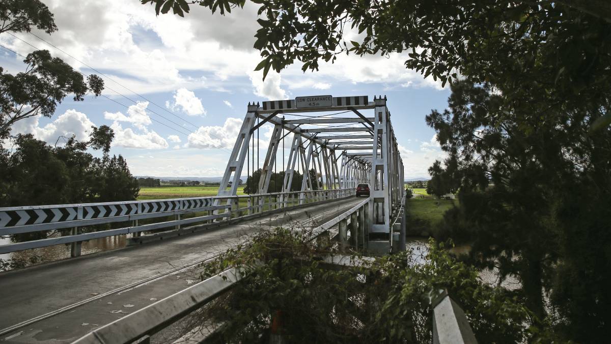
Bridges that cross creeks and rivers often have stormwater drains that empty directly over the waterways. When it rains, stormwater flushes whatever is on the bridge through the drains into the water below, including 6PPD-quinone. There is a term for a die-off of salmon caused by flushing this toxin into waterways: Urban Runoff Mortality Syndrome (URMS).
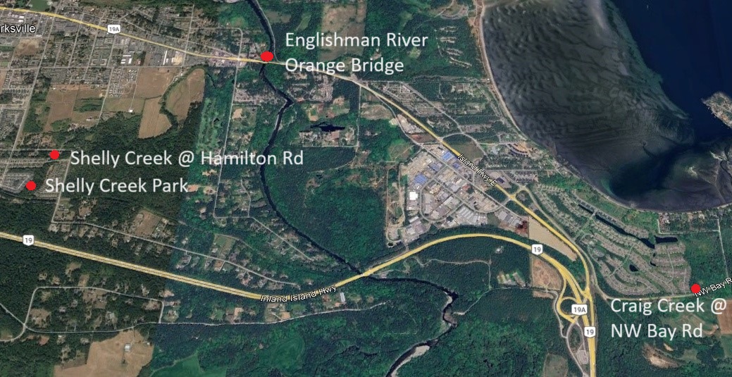
BCCF is partnering with stewardship groups on the east coast of Vancouver Island to learn what extent 6PPD-quinone exists within our waterways, focusing on those that are utilized by salmon. MVIHES volunteers have been collecting water samples downstream of bridges in the Parksville area since 2022. Sampling events are based on weather, particularly heavy rain following a 48-hour dry period when contaminants are most likely to be flushed into waterways.
Our first sampling location was the Englishman River downstream of the Orange Bridge. 6PPD-quinone was not detected in any of the samples collected, probably because the river is a large waterbody providing a lot of dilution (unlike Brothers and Piercy Creeks) and traffic across the bridge is much lighter than in West Vancouver.
Sampling locations (above map) moved to smaller salmonid creeks in 2023 and include: Shelly Creek where the resident Cutthroat Trout hang out in Shelly Creek Park; Shelly Creek downstream of the crossing at Hamilton Rd; and Craig Creek in Craig Bay downstream of Northwest Bay Rd. So far, none of the samples collected from Shelly Creek contained detectable levels of the toxin.
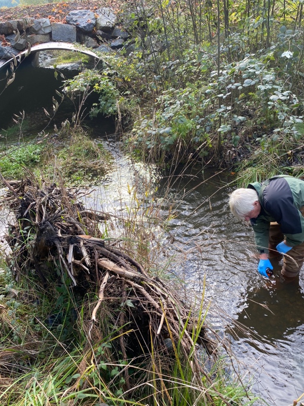
Volunteer Dick Dobler is shown in the left-hand photo preparing to collect a sample from Craig Creek. One sample from Craig Creek contained a trace amount of 6PPD-quinone (0.003 parts per billion, below lethal concentration of 0.8 parts per billion) while concentrations in the other samples were non-detectable.
The relatively low traffic at these crossings are probably the reason for the non-lethal concentrations of 6PPD-quinone in these small waterway.
We'll continue monitoring our local waterways for 6PPD-quinone and keep you up to date on the results.
Many thanks to our volunteers and Haley Tomlin at BCCF.
It's National Volunteer Week so time to celebrate and thank our awesome volunteers by showing off what they've been up to.
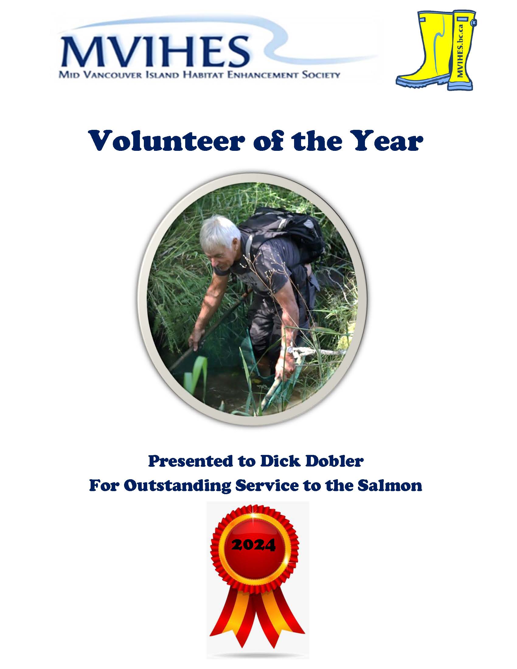
Volunteer of the Year
MVIHES has started something new this year and that is selecting a Volunteer of the Year. Our selection is not based solely on charm, wit and style (although our volunteers do have charm, wit and style) but on their participation in our projects and going the extra mile for salmon. This year's volunteer is...drum roll please.....
Dick not only participates in most of our activities, he rescues fry trapped in small isolated pools in creeks and rivers and behind beaver dams. He also helps with the maintenance of the Englishman River Regional Park, all with a cheerful and positive attitude. Congratulations Dick!
Annual Smolt Count
MVIHES volunteers and the BC Conservation Foundation (BCCF) were busy on March 25 installing the smolt trap for our annual count of coho salmon smolts as they migrate out of Shelly Creek into the Englishman River on their way to the ocean. Coho smolts, along with a few trout, are corralled by the smolt fence and directed through a pipe (seen in the left-hand photo) into a large metal box.
Every morning at 9 am our volunteers open the smolt box (seen in the right-hand photo) to count all the fish and measure some of the salmon and trout before releasing them back into the creek. We've caught over 400 coho smolts, 16 rainbow trout, and 8 cutthroat trout so far. Water temperatures are still pretty cool (below 8 degrees C most days) so we anticipate the peak of the migration is yet to come. One year we counted almost 9000 smolts.
A great blue heron and a river otter are regular visitors to Martindale Pond (a wetland in Shelly Creek just upstream of the smolt fence). One morning a pair of common mergansers was also partaking in the smorgasbord. The fish better get a move on before they're all eaten. The regular presence of predators is a good indicator that Shelly Creek is a productive salmon creek.
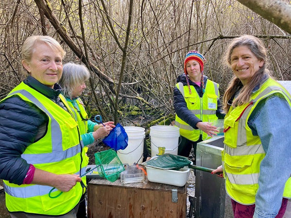
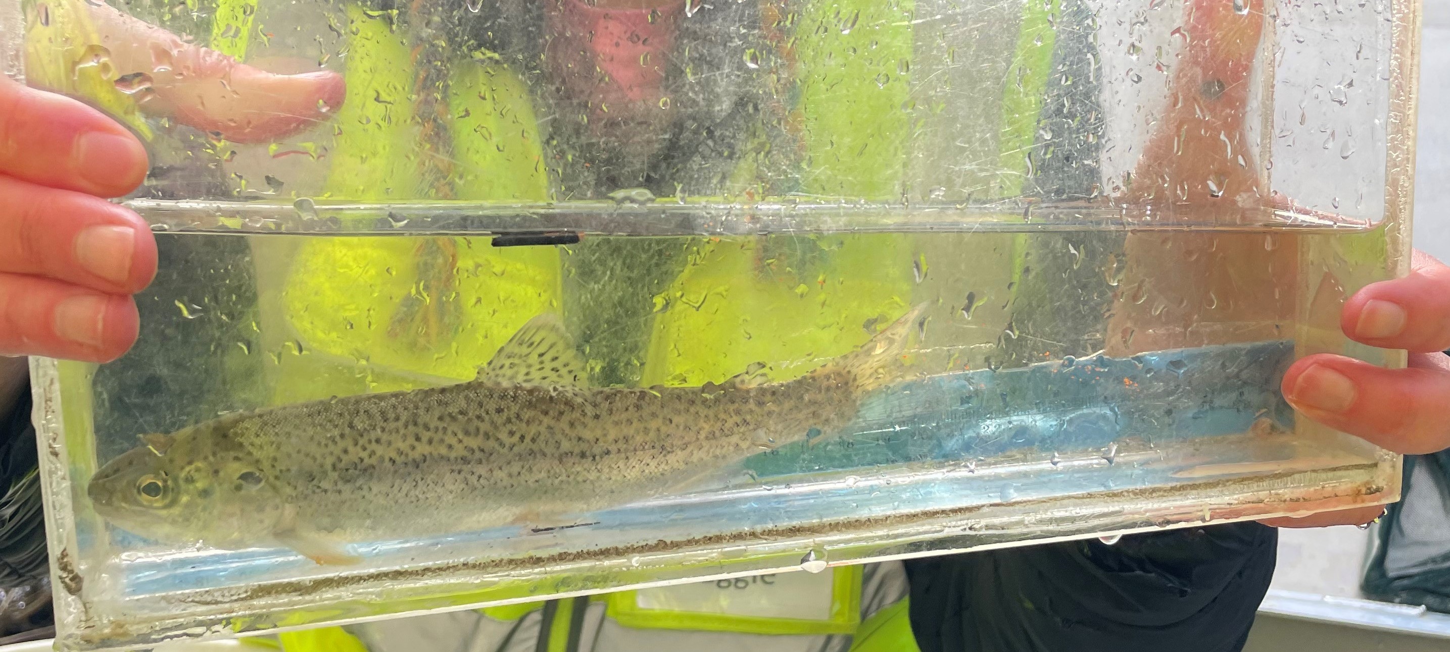
The lengths of the smolts average around 9 cm while some of the trout have been much bigger. So far, we've measured rainbow trout up to 19.8 cm long and cutthroats up to 26 cm! And, we caught a fish that BCCF believes is a hybrid between a cutthroat and a rainbow trout (seen in the right-hand photo below). A cutbow! How cool is that? BCCF is PIT tagging the salmon smolts and trout caught in our smolt box again this year for the Salish Sea Survival Study. A few of our volunteers on the smolt count are in the left-hand photo below.
l. to r. Cathy Kuntz, Jo McIlveen, Maggie Estok, Shelley Goertzen. Photos taken by Sue Wilson
Other volunteers involved with the smolt count are: Jeff Allen, Gord Armbruster, Terry Baum, Marilyn Bilsbarrow, Denis Cote, Dick Dobler, Carmel Lowe, Barb Riordan, Barbara Wildman-Spencer and Bob Williams. Thanks to Ally Badger and Thomas Negrin of BCCF for assisting in the installtion of the smolt trap and PIT tagging our fish.
If you would like to join the fun and count coho smolts with us, you can sign up here or send an email to Shelley at This email address is being protected from spambots. You need JavaScript enabled to view it.
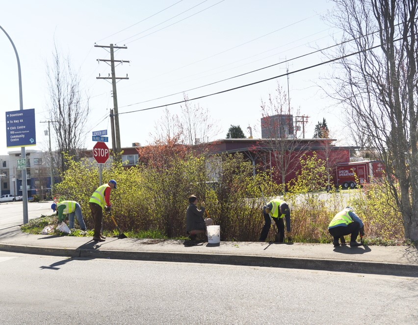
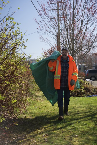
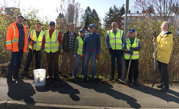
The Parksville Rain Garden Receives Some TLC
On April 13, nine volunteers led by Team Leader, Bob Williams, descended on the Parksville Raingarden at the Firehall to give it some much needed weeding and pruning (left-hand photo). You may already know that rain gardens provide an important service to salmon. Rainwater that runs off roofs, driveways, parking lots, and roads picks up pollutants such as oil, detergents from powerwashing, moss-controlling chemicals from roofs, weedkiller, and litter (plastics) before flowing into stormwater drains and storm sewers which empty directly into creeks, rivers and the ocean.
This rainwater doesn't get a chance to soak into the ground and add to the groundwater that provides flow to creeks and rivers during the dry months of summer. Rain gardens are designed to intercept rainfall runoff and filter out pollutants while allowing the water to infiltrate the ground.
The Parksville Rain Garden was constructed in 2012 under a partnership between MVIHES and the City of Parksville. The rain garden mitigates rainfall runoff from the the Firehall parking lot. MVIHES has been maintaining the vegetation in the rain garden since 2021.
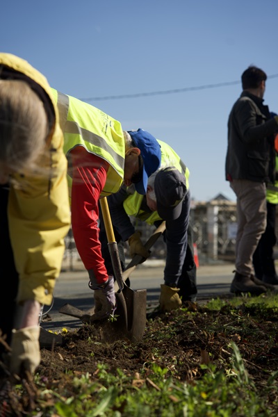
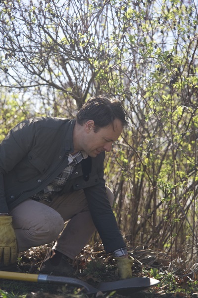
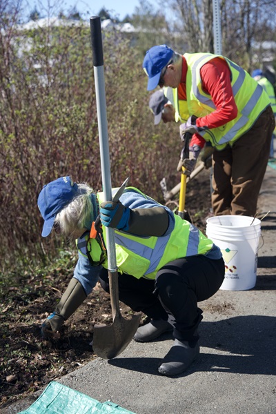
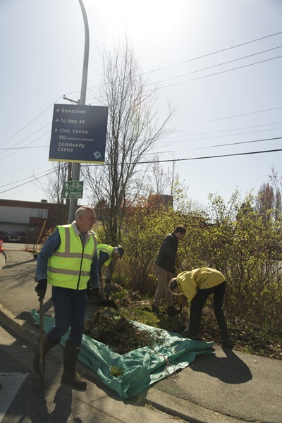
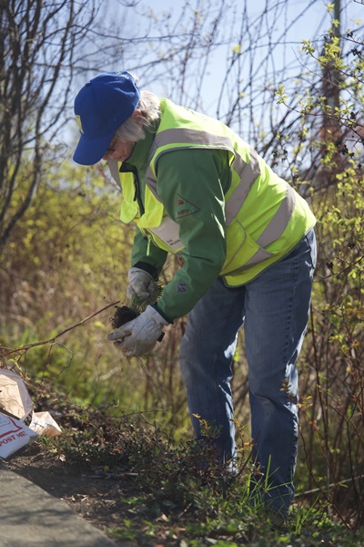
The photos below were taken by our Social Media Co-ordinator, Polina Iudina, and show our volunteers in action. MLA Adam Walker, in the middle photo below, joined us and got down to work. Himalayan blackberry, ivy, and weeds were removed while bald-hipped rose, red-osier dogwood and red currant were pruned back. Many thanks to the City of Parksville for hauling away all the trimmings.
From l. to r. Bob Williams, Dick Dobler, Doug Herchmer, Adam Walker, Sue Wilson, Brenda Riley, Gord Almond, Jo McIlveen, Cathy Hamlen, absent Yana Maltais
You can watch a video with an explanation about rain gardens by Bob and Adam here.
Friends of Shelly Creek Park Invasive Plants Removal
Thanks to Sue Wilson and her dedicated volunteers, along with Warren Payne, City Parks Supervisor, loads of invasive species such as lamium (yellow archangel) and Himalayan blackberry are being eradicated from Shelly Creek Park. The park is home to a resident Coastal Cutthroat Trout population, a blue-listed species of concern in BC. By removing invasive species and replacing them with native plants, they are maintaining the health of the forest ecosysytem that protects and nourishes Shelly Creek and the trout. This work has been ongoing since 2022.
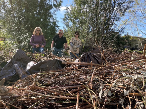
The photo below shows a few of the many volunteers surveying the big pile of Himalayan blackberry canes that were cut in March. More canes were cut on April 10, when the photo was taken, which the City of Parksville will be hauling away.
l.to r. Gene Gapsis, Del Rokosh, Nancy Pezel
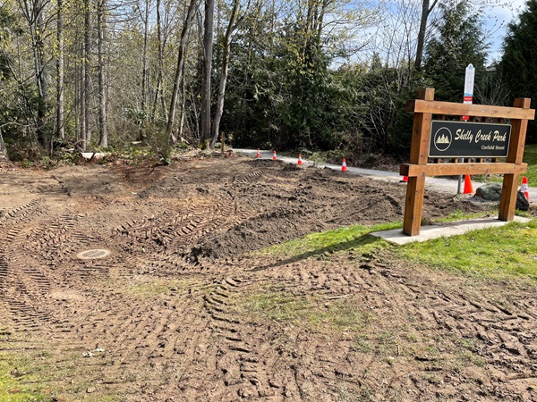
A City worker expertly removed a very dense patch of blackberry at the park entrance with a backhoe, leaving native shrubs intact, shown in the photo below. Well done and thank you to the volunteers and the City.
You can follow the activities of the Friends of Shelly Creek Park here.
WE ARE SO THANKFUL FOR ALL THE GREAT VOLUNTEERS MAKING A DIFFERENCE FOR SALMON!
 One gorgeous weekend in June, seventeen volunteers gathered at French Creek to learn how to assess fish habitat and stream health through a Streamkeeper Course. The course is available from the Pacific Streamkeepers Federation who provide support and education to groups like MVIHES.
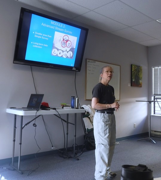

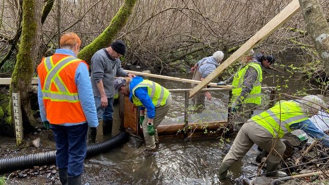 MVIHES volunteers and the BC Conservation Foundation (BCCF) were busy on March 25 installing the smolt trap for our annual count of coho salmon smolts as they migrate out of Shelly Creek into the Englishman River on their way to the ocean. Coho smolts, along with a few trout, are corralled by the smolt fence and directed through a pipe (seen in the left-hand photo) into a large metal box.
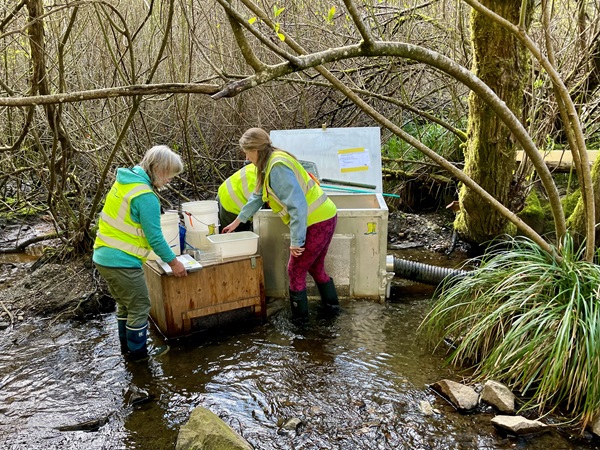
 l.to r. Gene Gapsis, Del Rokosh, Nancy Pezel